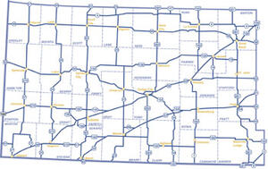


Three physiographic areas make up Southwest Region, which includes 28 counties in the southwest quarter of the state. In its western half, Region 3 is primarily High Plains, dominated by intensive dryland and irrigated farming operations mixed with native shotgrass prairie. Through the central part of this region is a landscape called the Arkansas River Lowlands, which follows the Arkansas River and is made up of sandhill grasslands. The southeast corner of the region is within the Red Hills, a rough, hilly mid-grass prairie landscape that is still largely intact. The mix of physiographic types and farming in this region provide outstanding combination pheasant, quail, white-tailed and mule deer, lesser prairie chickens and Rio Grande turkey hunting opportunities. While there are no federal reservoirs in Region 3, there are two state parks located on state fishing lakes – Meade State Park and Scott State Park. Cheyenne Bottoms Wildlife Area, one of the most important wetlands in the world, is also located within Region 3.
