Rivers and Streams Access
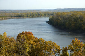
Most streams and rivers in Kansas are privately owned. The public rivers are the Kansas, Arkansas and Missouri (shown at right). They are open to the public between the ordinary high water marks on each bank. This is the line that can be seen where high water has left debris, sand, and gravel during its ordinary annual cycle. When these rivers flow through private land, permission is needed from adjacent landowners to access the rivers as well as when picnicking, camping, portaging or engaging in any other activity on the adjacent private lands.
Except where they pass through the legal limits of a government entity, the rest of our streams and rivers are privately owned, and permission is needed from the landowners to access and use the streams and adjacent lands for any purpose.
The Kansas River was designated as a National Water Trail on July 14, 2012. Known locally as the Kaw, the Kansas River begins at the confluence of the Republican and Smoky Hill Rivers near Junction City and flows 173 miles to Kansas City where it joins the Missouri River. The Kansas River watershed drains almost the entire northern half of Kansas and part of Nebraska and Colorado (53,000 square miles). The major cities along the Kansas River include Junction City, Manhattan, Topeka, Lawrence and Kansas City.
Visit Kansas River Trail for information about enjoying this spectacular prairie river.
More Info: National Water Trails System
The Arkansas River travels about 1,469 miles from its origin near Leadville, Colorado, through Kansas and Oklahoma to its confluence with the Mississippi River at Napoleon, Arkansas. In Kansas, the Arkansas River is pronounced “Ar-Kansas,” and is sometimes shortened to the “Ark River.” A 192-mile portion of the Arkansas River in Kansas was designated as a National Water Trail on June 3, 2016. The trail begins in Great Bend and ends at the Kansas-Oklahoma border southeast of Arkansas City. The Ark River is prone to seasonal reductions in flow. When the flow is low, the river divides into several small channels flowing in a broad, shallow bed. During drier periods, it may run dry on its surface in southwest Kansas, but picks up water as it flows through the state. By the time it reaches Wichita, there is often plenty of water for a scenic, leisurely float trip.
Arkansas River Access in Kansas
- Interactive Google Map of Access Points
- Access Points Guide and Float Trip Info: Arkansas River Coalition
- Wichita - River Fishing and Boating Info: Wichita Park and Recreation Dept.
More Info:
Wetlands and Wildlife National Scenic Byway: Arkansas River’s Great Bend
The Missouri River flows through the northeastern border of Kansas – separating Missouri and Kansas – and travels through 10 states on its journey from its origin near Three Forks, Montana to the Mississippi River at St. Louis, Missouri. In Kansas, the cities of Atchison, Leavenworth and Kansas City are among the communities that settled on the Missouri River.
Missouri River Access in Kansas
- Kansas City: Kaw Point Park
- Leavenworth: just south of the K-92 bridge over the Missouri River
- Atchison: Riverfront Park
- White Cloud: north of the K-7/Main Street intersection on the east side of K-7
- Elwood: under the US-36 bridge over the Missouri River
More Info:
Missouri Dept. of Conservation (Missouri River II map)
Missouri Dept. of Natural Resources Lewis and Clark Water Trail
Many streams provide excellent channel and flathead catfishing, and those in the east and southeast may also hold spotted bass. A little research and legwork visiting with landowners could open some great stream fishing.
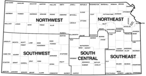
Region 1 (Northwest Kansas)
Region 2 (Northeast Kansas)
Region 3 (Southwest Kansas)
Region 4 (South Central Kansas)
Region 5 (Southeast Kansas)


